Map of the Former Territorial Limits of the Cherokee "Nation of" Indians
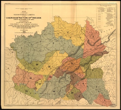
In 1884, C.C. Royce created a map showing the Cherokee Indian territory. He titled it Map of the Former Territorial Limits of the Cherokee “Nation of” Indians. This is a document that shows the land that the Cherokee people gave to the settlers in 1884. Therefore, this land originally belonged to the Cherokee Indian people along with the land that they kept. This shows just how large the Cherokee territory was at this time period. This map is currently in the Library of Congress Geography and Map Division located in Washington, DC.
This map can be enlarged here: http://www.loc.gov/item/99446145/
This map can be enlarged here: http://www.loc.gov/item/99446145/
